Rainfall is necessary to water plants and crops, keep ecosystems balanced, and replenish our water sources. While significant rainfall can be a good thing for the region, it has a variety of consequences for our environment. For example, abundant rain causes runoff, pushing contaminates into water streams. In this Data Deep Dive, we take a look at how CWA’s water sensor data provides intelligent insights that empower our partner, Cleveland Metroparks, with the ability to monitor watershed water quality and park conditions and take action to manage the parks when stormwater overflow events occur during heavy rainfall.
Listen to this article
The impact of rainfall on an environment is a critical focal point for organizations dedicated to preserving our natural landscapes. Cleveland Water Alliance partners with Cleveland Metroparks by providing advanced sensor technology to monitor and analyze the effects of ecological events on local watersheds. This collaboration is crucial in understanding how rainfall, among other factors, influences water quality, stream response, and the effectiveness of stormwater management practices within the Metroparks.
We spoke with Stream Restoration Ecologist Elizabeth Hiser from Cleveland Metroparks to get insight into the impact this sensor data has on Metroparks Operations.
"I value being able to visualize data and analyze storm events, stream response, and stormwater control measure effectiveness in real-time,” highlights Hiser. “While we rely heavily on volunteer and staff-collected data to help prioritize and manage our watersheds, those data points only provide single points in time and are typically collected and analyzed in different periods. The continuous and real-time nature of the data captured by the sensors is a unique and valuable tool in our watershed management toolbox."
![[Full-Width]](https://cdn.prod.website-files.com/6377d77ba46f434de6088bc4/66f1b8e0da7c65d352775d1a_66f1b6793c598435b784c196_Quote%2520-%2520How%2520Significant%2520Rainfall%2520Impacts%2520Watershed%2520Management%2520with%2520Cleveland%2520Metroparks.png)
In this edition of the Data Deep Dive series, we explore the crucial role of this real-time data, collected by Cleveland Water Alliance's Smart Lake Erie Watershed (SLEW), in managing and protecting Cleveland Metroparks. We'll delve into the environmental impacts of stormwater, analyze the effects of a 2023 “severe storm” on water quality within the parks, and examine how this data empowers Metroparks to safeguard wildlife, manage watersheds, and maintain park infrastructure.
The Data Deep Dive Series
Cleveland Water Alliance’s Smart Lake Erie Watershed (SLEW) is a telecommunications network stretching over 6,500 square miles with monitoring devices that span Lake Erie. The network provides vital data about the health and conditions of the lake. To share these crucial insights with organizations, innovators, and the public, we launched the blog series Data Deep Dive, where we explore water topics, analyze weather events, and discuss the importance and implications of the data gathered from our network.
In our previous Deep Dive, we explored hypoxia and its impacts on our water and aquatic ecosystems. We spoke to experts at Aqua Ohio and Freeboard Technology, discussing the importance of SLEW data in treating drinking water and managing plant operations. In this edition, let’s explore stormwater – what it is, its environmental impacts, and the heavy rainfall data that our smart sensors collected.
Cleveland Metroparks’ Rain Gardens Soak Up Heavy Showers
Stormwater refers to water that comes from precipitation (e.g., rain, snow, and hail) that is not readily absorbed into the ground after a precipitation event. Heavy rain or snowfall is a natural occurrence and essential to replenishing our water supplies. Rainfall is necessary to water plants and crops, keep ecosystems balanced, impact the movement of oceans, and more. Too much rain can be problematic, however; it can cause flooding, soil erosion, and mudslides. Pollution and hazardous materials in the atmosphere and in the grounds can also become absorbed into the water, distributing contaminants to our waterways, and impacting the overall water quality and the environment.
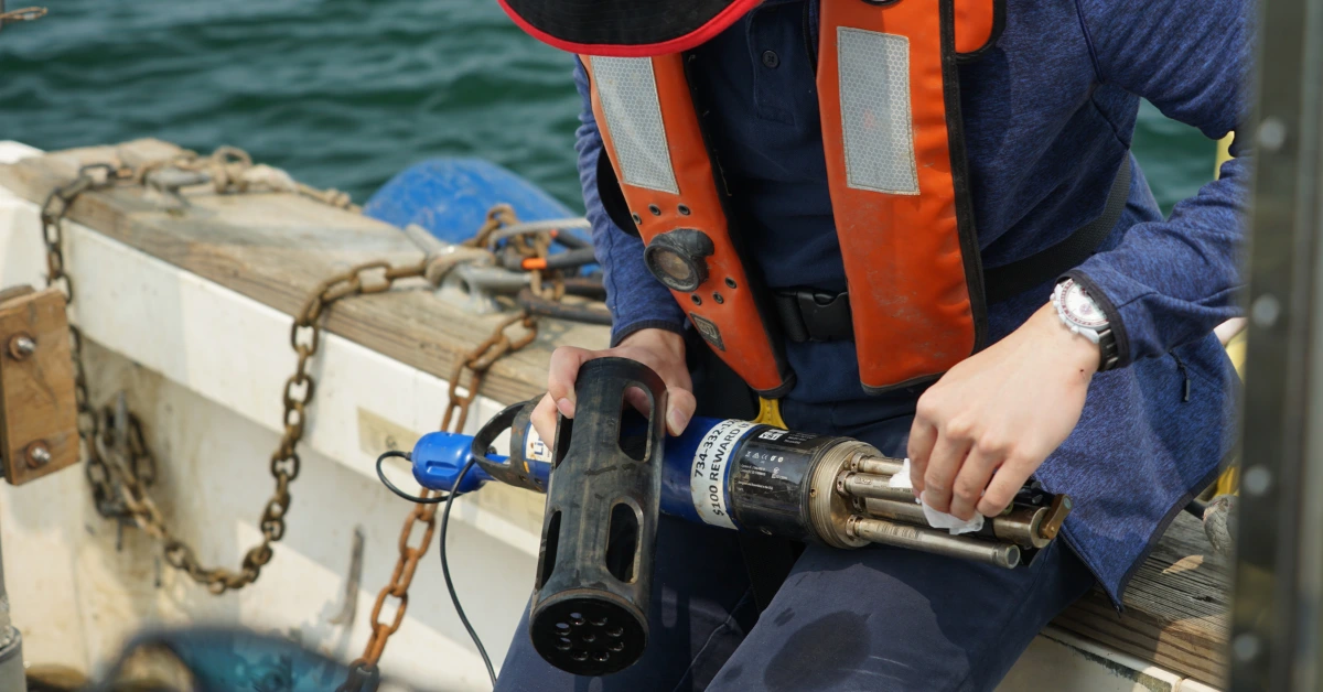
As part of our monitoring efforts, CWA has installed water quality sensor kits to monitor water and soil conditions at various sites. Through a partnership with Cleveland Metroparks, CWA smart sensors are mounted at two Cleveland Metroparks monitoring sites - Garfield Park Reservation and the Brookside Reservation Bear Parking Lot Bioretention Site. These sensors detect and document important environmental impacts, including rainfall and its effects on the parks.

[Callout 1]
On July 20th, 2023, a severe thunderstorm swept through Cleveland, causing a rapid change in environmental conditions. At the Garfield Park Reservation, our water quality sensor kits observed a sudden increase in water levels – with the height of the water increasing by over 3 feet (from 0.98 ft. to nearly 5 ft.). The monitored streams experienced substantially lowered water quality while other factors exponentially increased. Turbidity (the cloudiness of the water) and Dissolved Oxygen (the amount of oxygen in the water) rose eight times and five times their normal levels, respectively. In contrast, Specific Conductance decreased by 10 times.

[Callout 2]
Shifts in conductivity generally indicate a change in water quality and may signal the presence of contaminants or an increase in sediment or particles in the water. Excessive rainfall creates runoff and the potential for pollutants to enter streams, lakes, and rivers, substantially impacting aquatic life and the overall quality of our water.
Additionally, “When there’s significant rainfall, there is sometimes a discharge of untreated sewage mixed with stormwater into the storm system and waterways. This impacts fish, wildlife, and recreation,” explains Cleveland Metroparks Stream Restoration Ecologist, Elizabeth Hiser.
[Callout 3]
Untreated stormwater and wastewater that enter water systems contaminate the water, creating hazardous conditions for public health and safety while devastating aquatic life. To help mitigate runoff and the excess of sanitary sewer water, rain gardens (bioretention sites) have been integrated into our everyday environments. The sites are found on various public and commercial sites (like parks, parking lots, and walkways). Rain gardens work to absorb the additional precipitation, acting as a storage area that holds back and filters polluted stormwater runoff before it reaches sewer systems and our waterways. The strategic use of bioretention and rain gardens in the landscape can help mitigate combined sewer overflows.
CWA water quality kits documented the changes at the Brookside Reservation Bioretention site during the severe storm. Precipitation briefly measured 4 inches/hour, which is categorized as a “violent shower” by The United States Geological Survey (USGS).

Rainfall gets soaked into the soil, but additional water can oversaturate the ground. A vital measure of the soil conditions, soil moisture, measures the amount of water in the soil. Too much water in the soil can create drainage concerns, devastating plants and crops and potentially causing diseases. During the storm, the soil volumetric water content profile, the ratio of the volume of water to the unit volume of soil, increased to just under 50 percent. The soil was fully saturated throughout the entirety of the storm. After the shower, soil moisture decreased to its normal levels.
Heavy showers generate a lot of rainfall, creating a combined sewer overflow problem. The good news is that our rain garden sensors show that Cleveland Metroparks' bioretention facilities effectively capture increased amounts of rain. When you look at the data during the storm, the soil volumetric water profile shows four hours of full submergence in the rain garden.
![[Full-Width]](https://cdn.prod.website-files.com/6377d77ba46f434de6088bc4/66f2f66f616d91cf509cad52_66f2f65e73834a338d6793e4_Screen%2520Shot%25202024-09-24%2520at%25201.26.31%2520PM.png)
Intelligent Insights: Environmental Conservation, Resource Management, and Park Maintenance
Cleveland Metroparks Brookside Bioretention site in the Bear parking lot contains six bioretention practices with various plant palettes, including two tree & shrub basins, two turf basins, one perennial flower basin, and one native grass basin that help capture the additional precipitation. Access to sensor data gives the Metroparks insight into how the tree and shrub basin takes in water and provides feedback on the overall efficiency of bioretention sites.
“The data collected from the [CWA] sensors can help Metroparks examine questions like, ‘Does plant type affect water uptake?’ and ‘Do different types of pollution respond differently to different types of plants?’ Using the CWA sensors to monitor the performance and capacity of the bioretention can help contextualize the other information we gather to compare plant performance in these sites,” elaborates Hiser.

Included in Cleveland Metroparks' conservation efforts, the park manages over 25,000 acres of streams, forests, and wetlands. As the parks are a popular site for visitors with varied activities and interests, the Metroparks balances the needs of its natural systems and recreational use. Garfield Reservation is one site that had to balance the needs of nearby Wolf Creek along with the desire to bring back the historic recreational ponds that had previously filled in with sediment. To maintain this harmony, the newly restored Garfield Pond (used for fishing and kayaking) was constructed offline and beside Wolf Creek, rather than inline with Wolf Creek flowing through the pond like in the past.

Although pond and stream restoration efforts were successful, Wolf Creek will sometimes overflow into the pond. CWA sensors upstream of the pond can provide insights about water quantity, quality and the creek's potential impact to the pond and park infrastructure. These insights can assist park managers with cleaning, maintaining, and fortifying infrastructure. The information can assist Cleveland Metroparks to manage overall operations, track park conditions, and modify event plans.
“When water levels are changing, real-time alerts help park managers close down roads and bridges,” observes Hiser, “One time, a significant rainfall event took out our bridge where sensors were located… Data from these sensors can also help our team navigate if we need to cancel events due to water levels in the parks.”
But the value of the data doesn’t end there - Cleveland Metroparks also uses the technology for educational purposes. Working with Cleveland Water Alliance, Cleveland Metroparks has hosted calibration events for CWA. The Metroparks also display sensor data and share stories about rainfall events and their impacts, educating guests and the general public about ecosystems and how they operate. Additionally, as part of their community outreach and education efforts, the park hosts a community-led volunteer group called the Watershed Volunteer Program. This program collects water quality samples, monitors the parks watersheds, and helped shape CWA’s Lake Erie Volunteer Science Network as it was being developed in its early stages.
Collaboration That Fosters Practical Solutions and New Possibilities
Rainfall is a natural process that replenishes our water sources. Although rain is necessary, turbulent storms can create ripple effects on aquatic ecosystems and our water quality.
Cleveland Water Alliance maintains a robust partnership with Cleveland Metroparks. Leadership between both organizations works hand-in-hand to support their overall missions, with Joe Roszak, Cleveland Metroparks Chief Operating Officer, also serving on Cleveland Water Alliance’s Board of Directors. The valuable and essential work in monitoring and managing the Lake Erie basin continues through cooperation between the two organizations.
In their efforts to protect wildlife and ecosystems, CWA sensors help track water quality at several locations in the park and provide feedback on infrastructure and overall park operations.
"We’re always trying to approach things from a watershed perspective, thinking about the streams and how to minimize the need for restoration, and dealing with the source of a problem, rather than stopping the symptoms, " observes Hiser.
Overall, Cleveland Water Alliance smart sensors are a maintenance and management decision-making tool that can provide real-time data to freshwater stewards like Cleveland Metroparks. New applications will continue to advance with the technology and evolve with the needs of our ever-changing world, helping to achieve conservation efforts, watershed stewardship, monitoring, and restoration.
--
Recommended Reading
Urbanization and Stormwater Runoff by US EPA

Turbidity means "the cloudiness of the water" and Dissolved Oxygen can be defined as "the amount of oxygen in the water"

According to the Ohio State University’s Ohio Watershed Network, “Specific conductance (also called specific conductivity or just conductivity) is a measure of the ability of water to conduct an electrical current.”

“A combined sewer system collects rainwater runoff, domestic sewage, and industrial wastewater into one pipe. Normally, it can transport all of the wastewater to a treatment plant. Sometimes the amount of runoff exceeds the capacity of the system. When that happens, untreated stormwater and wastewater flow[s] into nearby waterbodies.” -According to the EPA


.svg)


.webp)


